architecture, urban design, planning
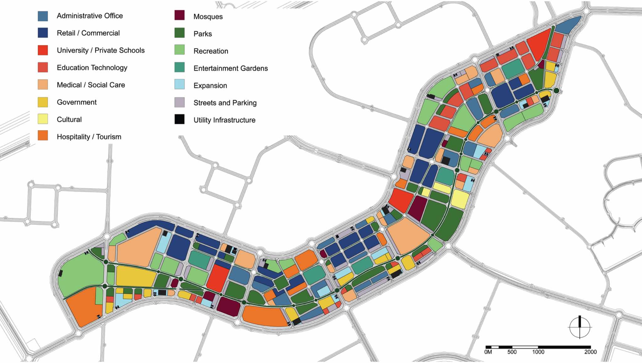
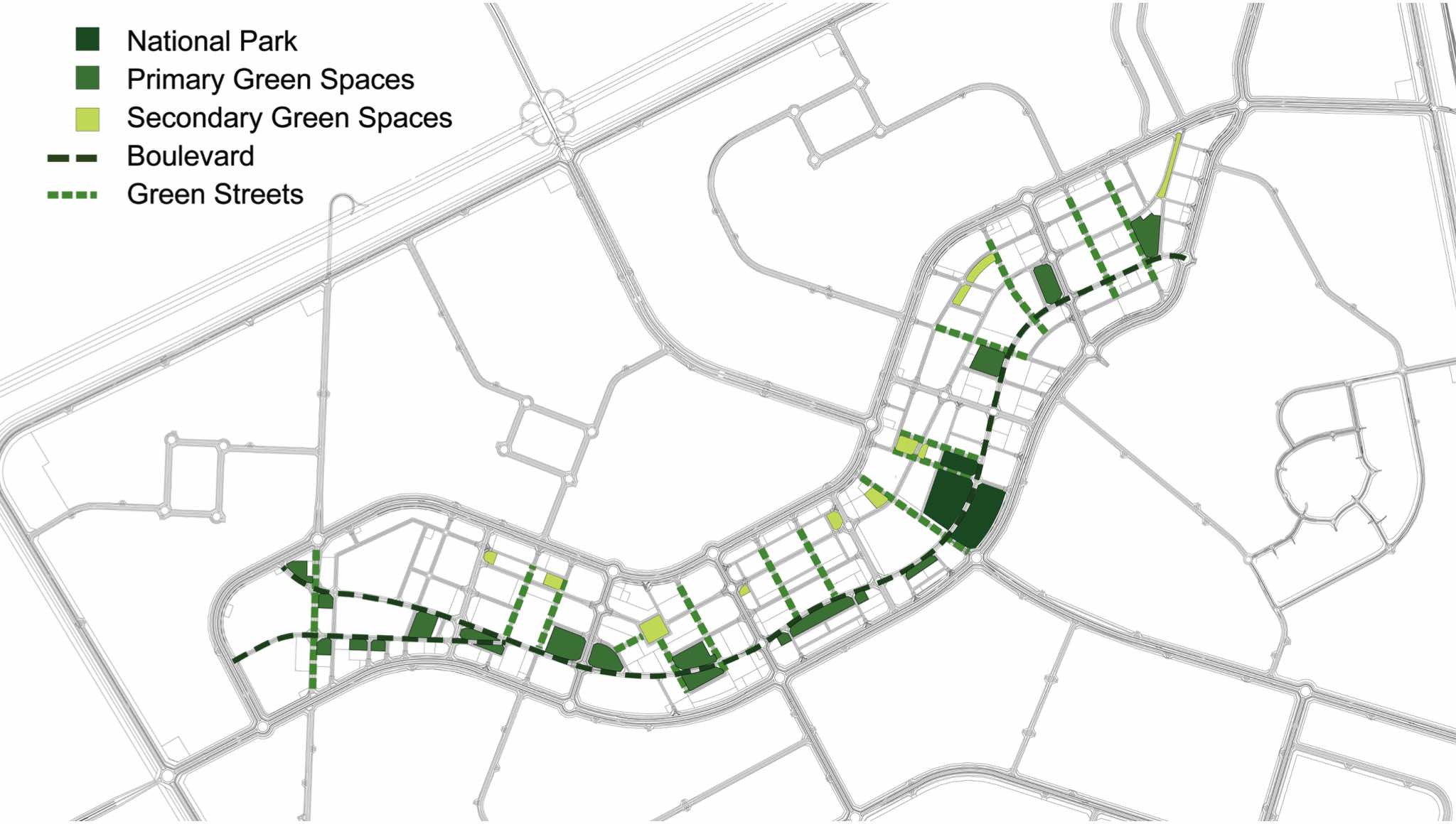
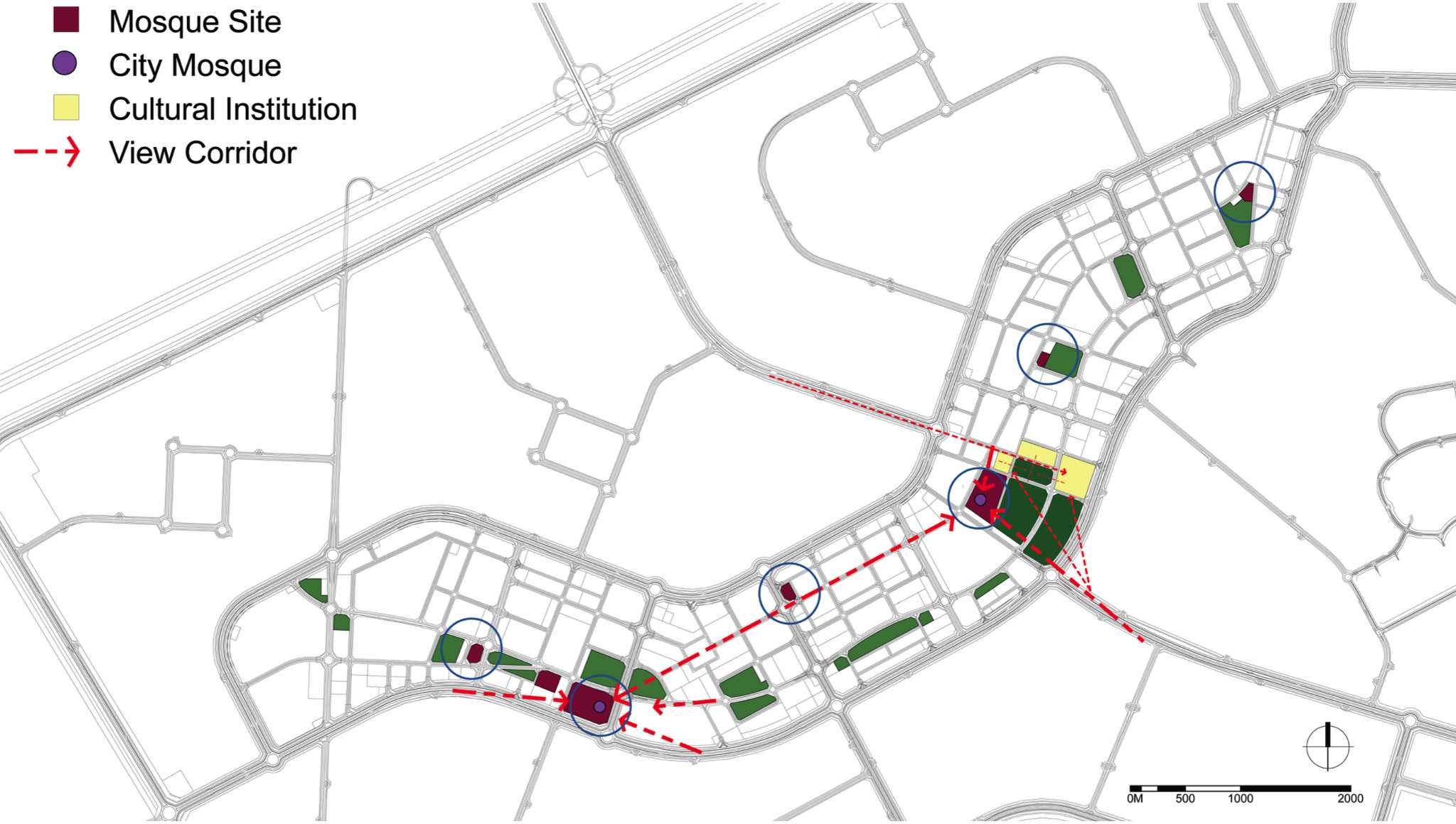
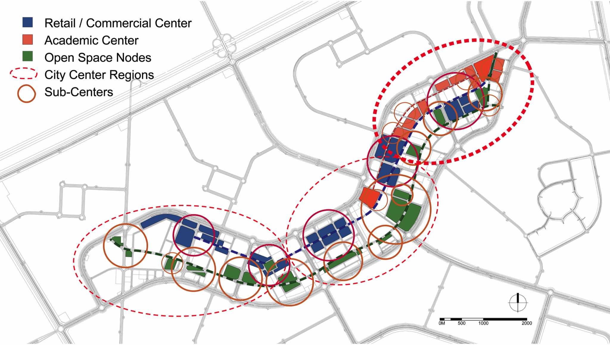
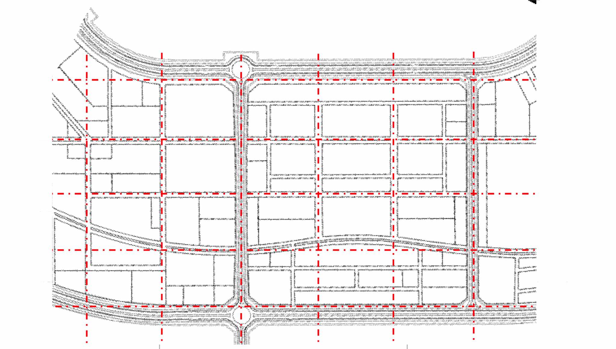
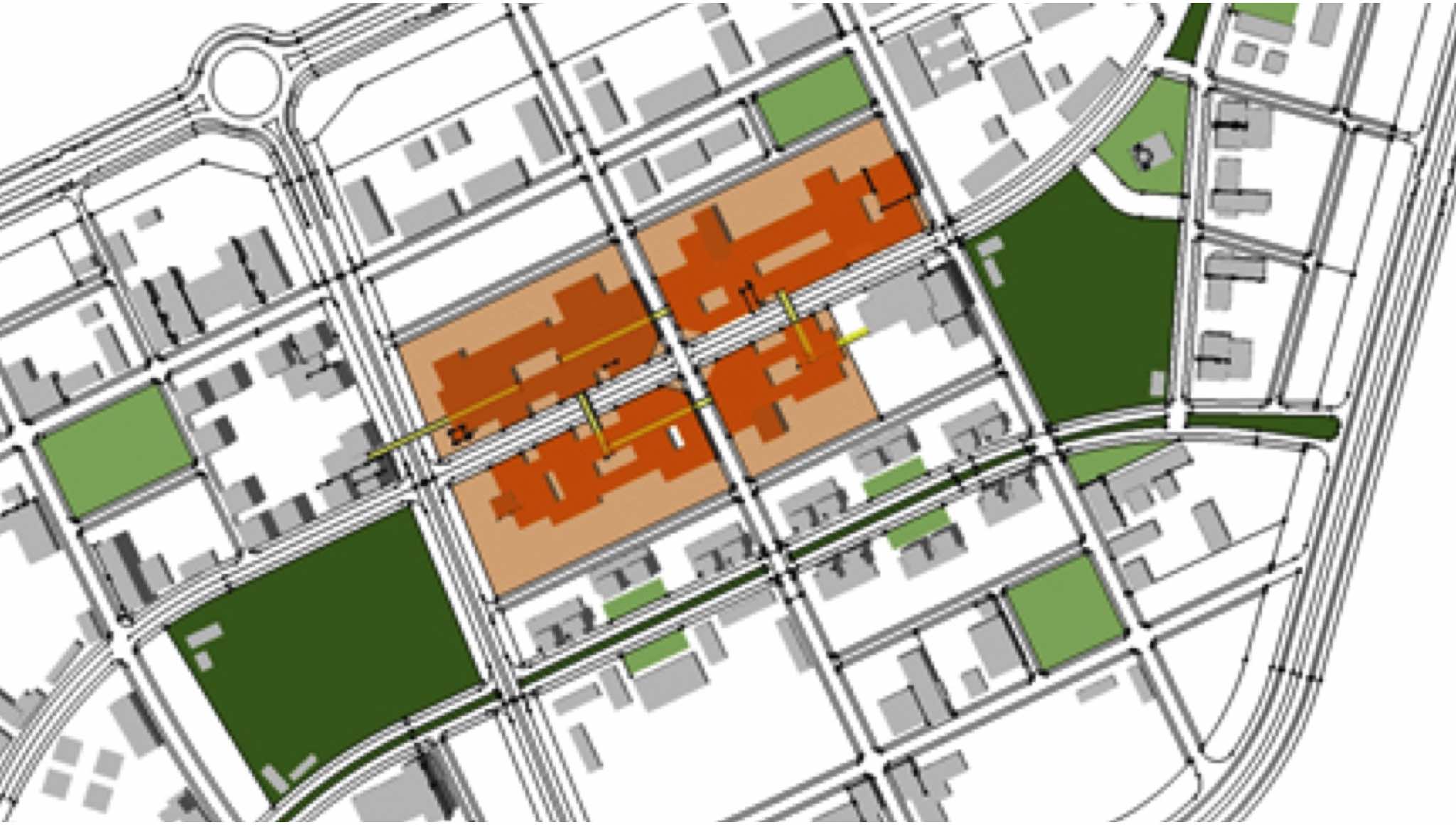
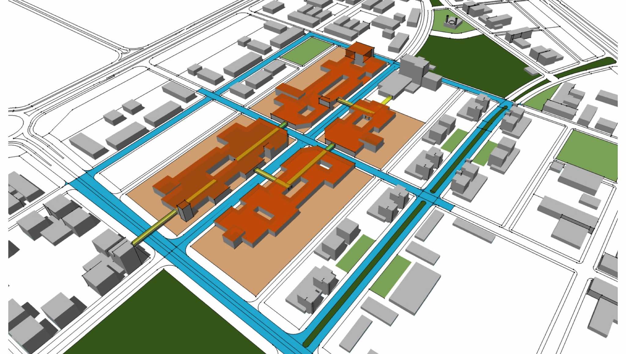
Al Khiran is a planned city of 600,000 residents to be located near the coast in southern Kuwait just north of Saudi Arabia. The city extends 12 KM by 16 KM (14,000 HA), or an area roughly equal to the size of Kuwait City. This satellite city is being built to supply additional housing for Kuwaiti nationals, so the bulk of the city consists of low-density single family residential development. Christopher Stienon developed the conceptual plans for the city center, residential quarters and the industrial district. The general organization of the city and the broader road network were established beforehand. The urban design organizes multiple urban systems; parks and open spaces, transportation and circulation, land uses, landscaping, and landmarks. The city center is organized around a pair of boulevards that span the entire length of the city center; one connects the major parks, cultural institutions and government buildings, and the second links the commercial areas. A block pattern was applied to the irregular shape of the city center as an organizational tool, but was then adapted to the site and the requirements of the individual land uses. A network of acclimatized pedestrian pathways and connecting bridges is layered atop the road system. This is a product of an extremely harsh climate and highly auto-centric Kuwaiti road standards. This yields a system of smaller-scale buildings that permit the incremental construction of commercial and retail centers that can be combined and expanded across road and property boundaries to create enormous internalized retail and commercial centers to rival those commonly found throughout Kuwait and the neighboring Gulf States. This building typology effectively balances the pace of commercial development with the nascent population of the emerging city.
Location: Al Khiran, Kuwait
Client: Public Authority of Housing Welfare, Kuwait
Services:
Concept Planning, Inital zoning and land use mapping, circulation and roadway alignments, initial massing and building concepts.
Detailed planning of the commercial center, residential and industrial districts.
